Environment and Climate Change
List of Near-Real Time Stations
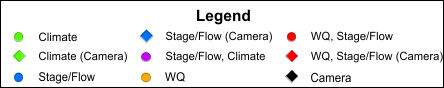
|
| Please note: The map cannot be viewed when using Internet Explorer. |
| Northern Labrador | ||||||||||||
| Tertiary Basin | Name | Stage-Flow | Vertical Datum | Flood Warning | WQ | Climate | Snow |
Water Temp |
GW | Camera | ADRS | EC |
| 03NE | Camp Pond | Stage | Assumed | 03NE003 | EC | |||||||
| 03NE | Camp Pond Brook below Camp Pond | Stage/Flow | Assumed | WQ | WT | NF03NE0010 | EC | |||||
| 03NE | Reid Brook at Outlet of Reid Pond | Stage/Flow | Assumed | WQ | WT | NF03NE0009 | EC | |||||
| 03NE | Reid Brook below Tributary | Stage/Flow | Assumed | WQ | WT | NF03NE0011 | EC | |||||
| 03NE | Tributary to Reid Brook | Stage/Flow | Assumed | WQ | WT | NF03NE0012 | EC | |||||
| 03NF | Ugjoktok River below Harp Lake | Stage/Flow | Assumed | HF | 03NF001 | EC | ||||||
| Western Labrador | ||||||||||||
| Tertiary Basin | Name | Stage-Flow | Vertical Datum | Flood Warning | WQ | Climate | Snow |
Water Temp |
GW | Camera | ADRS | EC |
| 03OC | Atikonak River above Panchia Lake | Stage/Flow | Assumed | WT | eMail Us | EC | ||||||
| 03OA | Dumbell Stream above Dumbell Lake | Stage | Assumed | WQ | WT | NF03OA0023 | EC | |||||
| 03OB | Elross Creek below Pinette Lake Inflow | Stage | Assumed | WQ | WT | NF03OB0039 | EC | |||||
| 03OA | Flora Creek below Trans Labrador Highway | Stage | Assumed | WQ | WT | NF03OA0022 | EC | |||||
| 03OB | Joan Brook below Outlet of Joan Lake | Stage | Assumed | WQ | WT | NF03OB0042 | EC | |||||
| 03OA | Luce Brook below Tinto Pond | Stage/Flow | Assumed | 03OA012 | EC | |||||||
| 03OA | Pumphouse Stream above Drum Lake | Stage | Assumed | WQ | WT | NF03OA0024 | EC | |||||
| 03OA | Wabush Lake at Dolomite Road | Stage | Assumed | WQ | WT | NF03OA0019 | EC | |||||
| 03OA | Wabush Lake at Lake Outlet | Stage/Flow | Assumed | WQ | WT | NF03OA0017 | EC | |||||
| 03OA |
Unnamed Tributary above Fraggle Rock Lake |
Elevation | CGVD28 | WQ | WT | NF03OA0025 | ||||||
| Churchill River and Lake Melville | ||||||||||||
| Tertiary Basin | Name | Stage-Flow | Vertical Datum | Flood Warning | WQ | Climate | Snow |
Water Temp |
GW | Camera | ADRS | EC |
| 03OE | Churchill River 6.15kms below Lower Muskrat Falls | Elevation/Flow | CGVD28 | FW | WQ | WT | NF03OE0050 | EC | ||||
| 03OD | Churchill River above Churchill Falls Tailrace | Elevation/Flow | CGVD28 | WT | 03OD008 | EC | ||||||
| 03OE | Churchill River above Grizzle Rapids | Elevation | CGVD28 | WQ | WT |
| 03OE013 | EC | ||||
| 03OE | Churchill River above Upper Muskrat Falls | Elevation | CGVD28 | WQ | WT | 03OE001 | EC | |||||
| 03OE | Churchill River at end of Mud Lake Road (Water Level) | Elevation | CGVD28 | FW | WT |
|
03OE018 | EC | ||||
| 03OE | Churchill River at end of Mud Lake Road (Camera) |
|
NLENCL0004 | |||||||||
| 03PC | Churchill River at English Point | Elevation | CGVD2013 | FW | WQ | WT | NF03OE0054 | EC | ||||
| 03OE | Churchill River at Happy Valley | Elevation | CGVD28 | FW | WT | 03OE016 | EC | |||||
| 03OD | Churchill River below Churchill Falls Tailrace | Elevation/Flow | CGVD28 | WT | 03OD010 | EC | ||||||
| 03OE | Churchill River below Metchin River | Elevation/Flow | CGVD28 | WQ | WT | NF03OD0013 | EC | |||||
| 03OE | Churchill River below Traverspine River | Elevation | CGVD28 | FW | WT |
|
03OE019 | EC | ||||
| 03PC | Goose River at Bridge |
|
NLENHM0001 | |||||||||
| 03OE | Metchin River near TLH (climate) | Climate | Snow | NLENCL0009 | ||||||||
| 03OE | Mud Lake Outlet Tributary at Mud Lake | Elevation | CGVD28 | FW | WT |
|
03OE017 | EC | ||||
| 03OE | Mud Lake Road MET | Climate | Snow | NLENCL0011 | ||||||||
| 03OE | Muskrat Falls MET | Climate | Snow | NLENCL0006 | ||||||||
| 03OE | Pinus River | Stage/Flow | Assumed | WT | 03OE011 | EC | ||||||
| 03PD | Rabbit Island at the Outlet of the Churchill River | Elevation | CGVD2013 | WT | 03PD002 | EC | ||||||
| 03OE | TLH between Churchill Falls and Lab City (climate) | Climate | Snow | NLENCL0008 | ||||||||
| Coastal and Southern Labrador | ||||||||||||
| Tertiary Basin | Name | Stage-Flow | Vertical Datum | Flood Warning | WQ | Climate | Snow |
Water Temp |
GW | Camera | ADRS | EC |
| 03QC | Alexis River near Port Hope Simpson | Stage/Flow | Assumed | HF | WT | 03QC002 | EC | |||||
| 03QC | Eagle River above Falls | Stage/Flow | Assumed | HF | WT | 03QC001 | EC | |||||
| 02XA | Little Mecatina River above Lac Fourmont | Stage/Flow | Assumed | HF | 02XA003 | EC | ||||||
| Northern Peninsula | ||||||||||||
| Tertiary Basin | Name | Stage-Flow | Vertical Datum | Flood Warning | WQ | Climate | Snow |
Water Temp |
GW | Camera | ADRS | EC |
| 02YA | Bartletts River near St. Anthony | Stage/Flow | Assumed | Precipitation | WT | 02YA002 | EC | |||||
| 02YF | Cat Arm Reservoir near Spillway | Elevation | NL Hydro Datum | 02YF002 | EC | |||||||
| 02YE | Greavett Brook above Portland Creek Pond | Stage/Flow | Assumed | 02YE001 | EC | |||||||
| 02YG | Main River at Paradise Pool | Stage/Flow | Assumed | HF | WT | 02YG001 | EC | |||||
| 02YD | Northeast Brook near Roddickton | Stage/Flow | Assumed | WT | 02YD002 | EC | ||||||
| 02YC | Torrent River at Bristols Pool | Stage/Flow | Assumed | HF | Precipitation | WT | 02YC001 | EC | ||||
| West Coast, Humber and Baie Verte | ||||||||||||
| Tertiary Basin | Name | Stage-Flow | Vertical Datum | Flood Warning | WQ | Climate | Snow |
Water Temp |
GW | Camera | ADRS | EC |
| 02YK | Boot Brook at Trans-Canada Highway | Stage/Flow | Assumed | WT | 02YK008 | EC | ||||||
| 02YL | Corner Brook Lake at Lake Outlet | Stage | Assumed | WT | 02YL009 | EC | ||||||
| 02YL | Deer Lake near Generating Station | Elevation | CGVD28 | FW | WT | 02YL007 | EC | |||||
| 02YK | Grand Lake East of Grand Lake Brook | Stage | NL Hydro Datum | 02YK010 | EC | |||||||
| 02YJ | Harrys River below Highway Bridge | Stage/Flow | Assumed | HF | WT | 02YJ001 | EC | |||||
| 02ZA | Highlands River at Trans-Canada Highway | Stage/Flow | Assumed | WT | 02ZA002 | EC | ||||||
| 02YL | Humber River at Humber Village Bridge | Stage/Flow | Assumed | HF | WQ | WT | NF02YL0012 | EC | ||||
| 02YL | Humber River at Humber Village Bridge - Weather Station | Climate | Snow |
|
NLENCL0003 | |||||||
| 02YO | Humber River at Nicholsville Bridge | Elevation | CGVD28 |
|
NLENHM0004 | |||||||
| 02YM | Indian Brook Diversion above Birchy Lake | Stage/Flow | Assumed | HF | WT | 02YM004 | EC | |||||
| 02YK | Lewaseechjeech Brook at Little Grand Lake | Stage/Flow | Assumed | HF | WT | 02YK002 | EC | |||||
| 02YJ | Northern Harvest FMW10 | WQ | WT | GW | NLGWFMW10 | |||||||
| 02YJ | Northern Harvest FMW12 | WQ | WT | GW | NLGWFMW12 | |||||||
| 02YJ | Northern Harvest MW5/6 | WQ | WT | GW | NLGWMW56 | |||||||
| 02YM | Outlet of the Steady at Rambler Mines | Stage | CGVD2013 | WQ | WT | NLENHM0002 | ||||||
| 02YL | Rattler Brook near Mcivers | Stage | Assumed | Precipitation | 02YL005 | EC | ||||||
| 02YK | Sandy Lake near Birchy Narrows (Camp 55) | Climate | Snow |
|
NLENCL0005 | |||||||
| 02YK | Sheffield Brook near Trans Canada Highway | Stage/Flow | Assumed | HF | WT | 02YK005 | EC | |||||
| 02YL | South Brook at Pasadena | Stage/Flow | Assumed | HF | WT | 02YL004 | EC | |||||
| 02YM | South West Brook near Baie Verte | Stage/Flow | Assumed | Precipitation | WT | 02YM003 | EC | |||||
| 02YL | Steady Brook above confluence to Humber River | Stage/Flow | Assumed |
|
02YL012 | EC | ||||||
| 02YL | Upper Humber River above Black Brook | Stage/Flow | Assumed | HF | WT | 02YL008 | EC | |||||
| 02YL | Upper Humber River above Black Brook (Weather Station) | Climate | Snow | NLENCL0007 | ||||||||
| 02YL | Upper Humber River near Reidville | Stage/Flow | Assumed | HF | WT | 02YL001 | EC | |||||
| Exploits River and Notre Dame Bay | ||||||||||||
| Tertiary Basin | Name | Stage-Flow | Vertical Datum | Flood Warning | WQ | Climate | Snow |
Water Temp |
GW | Camera | ADRS | EC |
| 02YO | Badger Brook below Foot Bridge | Elevation | CGVD28 | FW | WT | 02YO019 | EC | |||||
| 02YO | Beothuck Lake at Indian Point | Elevation | CGVD28 | 02YO017 | EC | |||||||
| 02YO | East Pond Brook below East Pond | Stage/Flow | Assumed | WQ | WT | NF02YO0192 | EC | |||||
| 02YO | Exploits below Noel Paul's Brook MET | Climate | Snow |
|
NLENCL0010 | |||||||
| 02YO | Exploits River at Badger | Elevation/Flow | CGVD28 | FW | 02YO013B | EC | ||||||
| 02YO | Exploits River at Badger East of Stadium - Weather Station | Climate | Snow |
|
NLENCL0002 | |||||||
| 02YO | Exploits River at Badger Steps |
|
NLENCM0001 | |||||||||
| 02YO | Exploits River at Bishop's Falls Trestle | Stage | Assumed |
|
NLENHM0003 | |||||||
| 02YO | Exploits River at Charlie Edwards Point | Elevation/Flow | CGVD28 | Precipitation | 02YO018 | EC | ||||||
| 02YO | Exploits River below Noel Pauls Brook | Stage/Flow | Assumed | HF | WT | 02YO011 | EC | |||||
| 02YO | Exploits River near Millertown | Stage/Flow | Assumed | WT | 02YO016 | EC | ||||||
| 02YO | Great Rattling Brook above Tote River Confluence | Stage/Flow | Assumed | HF | Precipitation | WT | 02YO008 | EC | ||||
| 02YN | Lloyds River Below King George IV Lake | Stage/Flow | Assumed | HF | WT | 02YN002 | EC | |||||
| 02YN | Marathon-Gold MET | Climate | Snow | NLENCL0014 | ||||||||
| 02YN | Northwest of Leprechaun Pit Monitoring Well | WQ | WT | GW | NLGWMG02 | |||||||
| 02YO | Peters River near Botwood | Stage/Flow | Assumed | Precipitation | WT | NF02YO0121 | EC | |||||
| 02YN | Roebucks Brook | Stage | Assumed | WQ | WT | NF02YN0049 | ||||||
| 02YN | South of Leprechaun Waste Rock Pile Monitoring Well | WQ | WT | GW | NLGWMG01 | |||||||
| 02YN | Southeast of TMF Monitoring Well (Deep) | WQ | WT | GW | NLGWMG03 | |||||||
| 02YN | Southeast of TMF Monitoring Well (Shallow) | WQ | WT | GW | NLGWMG04 | |||||||
| 02YN | Southwest Brook at Lewisporte | Stage/Flow | Assumed | HF | Precipitation | WT | 02YO012 | EC | ||||
| 02YN | Star Brook above Star Lake | Stage/Flow | Assumed | 02YN004 | EC | |||||||
| 02YO | Tributary to Gills Pond Brook | Stage/Flow | Assumed | WQ | WT | NF02YO0190 | EC | |||||
| 02YN | Valentine River Outlet | Stage | Assumed | WQ | WT | NF02YN0048 | ||||||
| 02YN | Victoria Lake at Northeast Control Structure | Stage | Assumed | 02YN005 | EC | |||||||
| 02YN | Victoria River Tributary | Stage | Assumed | WQ | WT | NF02YN0050 | ||||||
| 02YN | Victoria River Outlet | Stage | Assumed | WQ | WT | NF02YN0047 | ||||||
| 02YO | Duck Pond Well after Tailings Dam | WQ | WT | GW | NF02YO0193 | |||||||
| South Coast and Burin Peninsula | ||||||||||||
| Tertiary Basin | Name | Stage-Flow | Vertical Datum | Flood Warning | WQ | Climate | Snow |
Water Temp |
GW | Camera | ADRS | EC |
| 02ZF | Bay Du Nord River at Big Falls | Stage/Flow | Assumed | HF | 02ZF001 | EC | ||||||
| 02ZH | Come By Chance River near Goobies | Stage/Flow | Assumed | WT | NF02ZH0009 | EC | ||||||
| 02ZE | Conne River at Outlet of Conne River Pond | Stage/Flow | Assumed | HF | WT | 02ZE004 | EC | |||||
| 02ZG | Garnish River near Garnish | Stage/Flow | Assumed | WT | 02ZG001 | EC | ||||||
| 02ZC | Grandy Brook Below Top Pond Brook | Stage/Flow | Assumed | HF | WT | 02ZC002 | EC | |||||
| 02ZC | Granite Lake at East End | Stage | NL Hydro Datum | 02ZC004 | EC | |||||||
| 02ZD | Grey River near Grey River | Stage/Flow | Assumed | HF | 02ZD002 | EC | ||||||
| 02ZG | Grieg NL Monitoring Well | WQ | WT | GW | NLGWGA01 | |||||||
| 02ZB | Isle Aux Morts River below Highway Bridge | Stage/Flow | Assumed | HF | WT | 02ZB001 | EC | |||||
| 02ZG | John Fitzpatrick Pond | Stage | Assumed | WQ | WT | NF02ZG0012 | ||||||
| 02ZG | Outflow of Unnamed Pond south of Long Pond | Stage | Assumed | WQ | WT | NF02ZG0029 | EC | |||||
| 02ZH | Pipers Hole River at Mothers Brook | Stage/Flow | Assumed | WT | 02ZH001 | EC | ||||||
| 02ZG | Rattle Brook near Boat Harbour | Stage/Flow | Assumed | HF | WT | 02ZG004 | EC | |||||
| 02ZD | R.R. Pond near Granite Lake | Stage | NL Hydro Datum | 02ZD003 | EC | |||||||
| 02ZG | Salmonier River near Lamaline | Stage/Flow | Assumed | WT | 02ZG003 | EC | ||||||
| 02ZC | White Bear River above Big Indian Brook | Stage/Flow | Assumed | HF | 02ZC003 | EC | ||||||
| Trinity, Bonavista and Gander | ||||||||||||
| Tertiary Basin | Name | Stage-Flow | Vertical Datum | Flood Warning | WQ | Climate | Snow |
Water Temp |
GW | Camera | ADRS | EC |
| 02YQ | Gander River at Big Chute | Stage/Flow | Assumed | HF | WT | 02YQ001 | EC | |||||
| 02YR | Indian Bay Brook near Northwest Arm | Stage/Flow | Assumed | WT | 02YR003 | EC | ||||||
| 02YR | Middle Brook near Gambo | Stage/Flow | Assumed | WT | 02YR001 | EC | ||||||
| 02YS | Northwest River at Terra Nova National Park | Stage/Flow | Assumed | WT | 02YS006 | EC | ||||||
| 02ZJ | Salmon Cove River near Champneys | Stage/Flow | Assumed | HF | WT | 02ZJ002 | EC | |||||
| 02YQ | Salmon River Near Glenwood | Stage/Flow | Assumed | HF | WT | 02YQ005 | EC | |||||
| 02ZJ | Shoal Harbour River near Clarenville | Stage/Flow | Assumed | HF | WT | 02ZJ003 | EC | |||||
| 02ZJ | Southern Bay River near Southern Bay | Stage/Flow | Assumed | HF | WT | 02ZJ001 | EC | |||||
| 02YS | Southwest Brook at Terra Nova National Park | Stage/Flow | Assumed | WT | 02YS003 | EC | ||||||
| 02YS | Terra Nova River at Glovertown | Stage/Flow | Assumed | HF | WT | 02YS005 | EC | |||||
| 02YR | Triton Brook above Gambo Pond | Stage/Flow | Assumed | WT | 02YR004 | EC | ||||||
| Avalon Peninsula | ||||||||||||
| Tertiary Basin | Name | Stage-Flow | Vertical Datum | Flood Warning | WQ | Climate | Snow |
Water Temp |
GW | Camera | ADRS | EC |
| 02ZL | Big Brook at Lead Cove | Stage/Flow | Assumed | EC | ||||||||
| 02ZL | Butterpot Provincial Park (MEMP) | Climate | NLENMP0002 | |||||||||
| 02ZL | Forest Pond Buoy | WQ | WT | NLENWQ0005 | ||||||||
| 02ZM | Leary Brook at Prince Philip Drive | Stage/Flow | Assumed | WQ | WT |
|
NF02ZM0178 | EC | ||||
| 02ZK | Little Salmonier River Near North Harbour | Stage/Flow | Assumed | WT | 02ZK004 | EC | ||||||
| 02ZM | Northeast Pond River at Northeast Pond | Stage/Flow | Assumed | WT | 02ZM006 | EC | ||||||
| 02ZK | Northeast River near Placentia | Stage/Flow | Assumed | WT | 02ZK002 | EC | ||||||
| 02ZM | Paddys Pond | WQ | WT | NLENWQ0001 | ||||||||
| 02ZM | Pippy Park in St. Johns | Climate | NLENCL0001 | |||||||||
| 02ZK | Rattling Brook below Bridge | Elevation/Flow | CGVD28 | WQ | WT | NF02ZK0023 | EC | |||||
| 02ZK | Rattling Brook below Plant Discharge | Elevation/Flow | CGVD28 | WQ | WT | NF02ZK0025 | EC | |||||
| 02ZK | Rattling Brook Big Pond | Elevation | CGVD28 | WQ | WT | NF02ZK0024 | EC | |||||
| 02ZK | Rocky River near Colinet | Stage/Flow | Assumed | HF | WT | 02ZK001 | EC | |||||
| 02ZK | Sandy Pond Deep Well 1 | WQ | WT | GW | NF02ZK0029 | |||||||
| 02ZK | Sandy Pond Deep Well 2 | WQ | WT | GW | NF02ZK0031 | |||||||
| 02ZK | Sandy Pond Deep Well 3 | WQ | WT | GW | NF02ZK0032 | |||||||
| 02ZK | Sandy Pond Deep Well 4 | WQ | WT | GW | NF02ZK0028 | |||||||
| 02ZK | Sandy Pond Shallow Well 2 | WQ | WT | GW | NF02ZK0030 | |||||||
| 02ZM | Seal Cove Brook near Cappahayden | Stage/Flow | Assumed | WT | 02ZM009 | EC | ||||||
| 02ZL | Shearstown Brook at Shearstown | Stage/Flow | Assumed | WT | 02ZL004 | EC | ||||||
| 02ZM | South River Near Holyrood | Stage/Flow | Assumed | WT | 02ZM016 | EC | ||||||
| 02ZN | St. Shotts River near Trepassey | Stage/Flow | Assumed | HF | WT | 02ZN002 | EC | |||||
| 02ZK | Vale LH2 MET | Climate | NLENCL0013 | |||||||||
| 02ZM | Virginia River at Pleasantville | Stage/Flow | Assumed | WT | 02ZM018 | EC | ||||||
| 02ZM | Waterford River at Kilbride | Stage/Flow | Assumed | WQ | WT |
|
02ZM008 | EC | ||||
Note: The date/times shown on the graphs are NST. There is no adjustment made for Daylight Savings Time.
| The station characteristics described below give a general overview of the sensors installed at each site. | |
| Definitions | Description |
| Tertiary Basin | The Water Survey of Canada has a 3-level hierarchy of drainage areas for the purpose of managing hydrometric stations. The first two digits indicate the major drainage basin based on the ocean to which it flows. The last two letters indicate a sub-basin (tertiary ) of the major drainage basin. A full hydrometric station identifier ends in three digits which indicate the nth station installed in that basin. |
| Stage-Flow | Water elevation, stage and/or flow are measured. A more complete description of these terms is available here. |
| Vertical Datum | A vertical datum is a reference surface that represents zero, against which elevations are measured. The location of zero can be arbitrary (assumed datums), based on decades of level lines (CGVD28), or more recently; on a model of the planet’s gravity field from satellites (CGVD2013). Water Elevation (m) - CGVD2013 means water elevation is in the Canadian Geodetic Vertical Datum of 2013 Water Elevation (m) means water elevation is in the Canadian Geodetic Vertical Datum of 1928 Stage (m) means the water elevation is in an assumed datum. |
| Flood Warning | FW - Stage or Water Elevation graph at this station contains flood warning lines. HF - Streamflow graph at this station contains high flow alert lines. |